Connections to Other MDE and State Initiatives
Comprehensive Flood Management Grant Program (CFMGP)
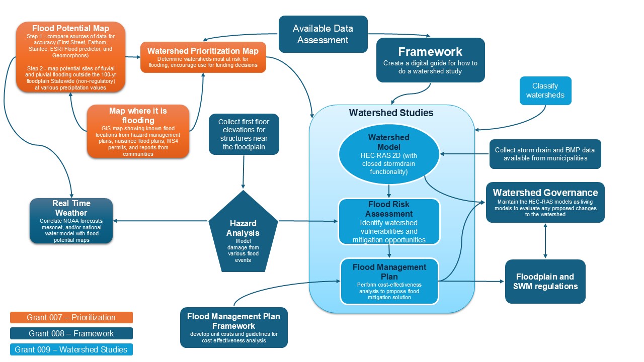
Maryland first performed watershed studies in the 1980s as part of the State's CFMGP initiative. This MDE program provided grants to local jurisdictions for comprehensive flood management studies, plans, and mitigation projects. Although some flood management plans were developed, and some are still in use, Maryland’s plan to develop flood mitigation plans in the 1980s was not fully implemented as originally envisioned.
Advancing Stormwater Resilience in Maryland (A-StoRM)
In response to growing local concerns regarding precipitation-based flooding, Maryland’s General Assembly enacted Chapter 641 of the 2021 Laws of Maryland, previously introduced as Senate Bill 227. This legislation made addressing precipitation-based flooding a priority for MDE. Known as A-StoRM, it required MDE to do three things: report on the most recent precipitation data available, investigate flood events since 2000, and update Maryland’s stormwater quantity management standards for flood control.
More information about MDE’s
A-StoRM efforts is available online. MDE has met or is in the process of meeting all three mandates. While developing strategies to meet A-StoRM requirements, MDE identified that comprehensive watershed studies complement its approach by providing a tool for applying appropriate stormwater quantity management in the watersheds most at risk for flooding.

