The cement plant mines over 3.5 million tons of limestone annually or about 12,000 tons per day of usage at the on-site Union Bridge site. In the near future, the Union Bridge quarry will be approaching the end of its limestone reserves. This project provides an estimated 70 years of limestone supply for the Lehigh Cement Company cement plant, which is the second largest of its kind in North America. The plant produces over two million metric tons of cement each year to supply the Northeast USA and Eastern Canada. Many other options were considered for the transportation of the limestone from the New Windsor quarry to the Union Bridge plant, including truck and rail, but the conveyor system proved to be the most ecologically- and community- friendly choice. The decision to pass under all road and stream crossings was in support of the community’s concerns related to the visual impact of an elevator conveyor system. The conveyor is designed to be underground at five of six road crossings, three streams and at some agricultural areas. The aboveground sections are completely covered with a continuous jumbo cover to reduce noise, nuisance lighting and completely eliminate dust, while preventing any un-authorized access. Areas where the conveyor is underground will remain agricultural lands for the life of the conveyor.
In order to mitigate the wetland and stream impacts from the project, Lehigh Cement permanently restored over three acres of wetlands and more than two miles of perennial stream in the Haines Branch Valley. The mitigation project started at Marble Quarry Road and travelled south, ending at Fountain School Road. The design of the mitigations, planted stream buffer, and stream channel will provide cleaner water into Haines Branch by significantly reducing nutrient and sediment loadings. The restorations include seasonal ox-bow wetlands, buffers of warm seasonal grasses and mixed forest types that are capable of sustainment in karst topography. Selection of plant species and hydraulic manipulations are designed to achieve habitat for host insects, passerine birds, waterfowl, small mammals, furbearers and herptiles. The restoration includes plant species and vegetative communities correlated to their respective hydrologic tolerances.
Shallmar Road Landslide
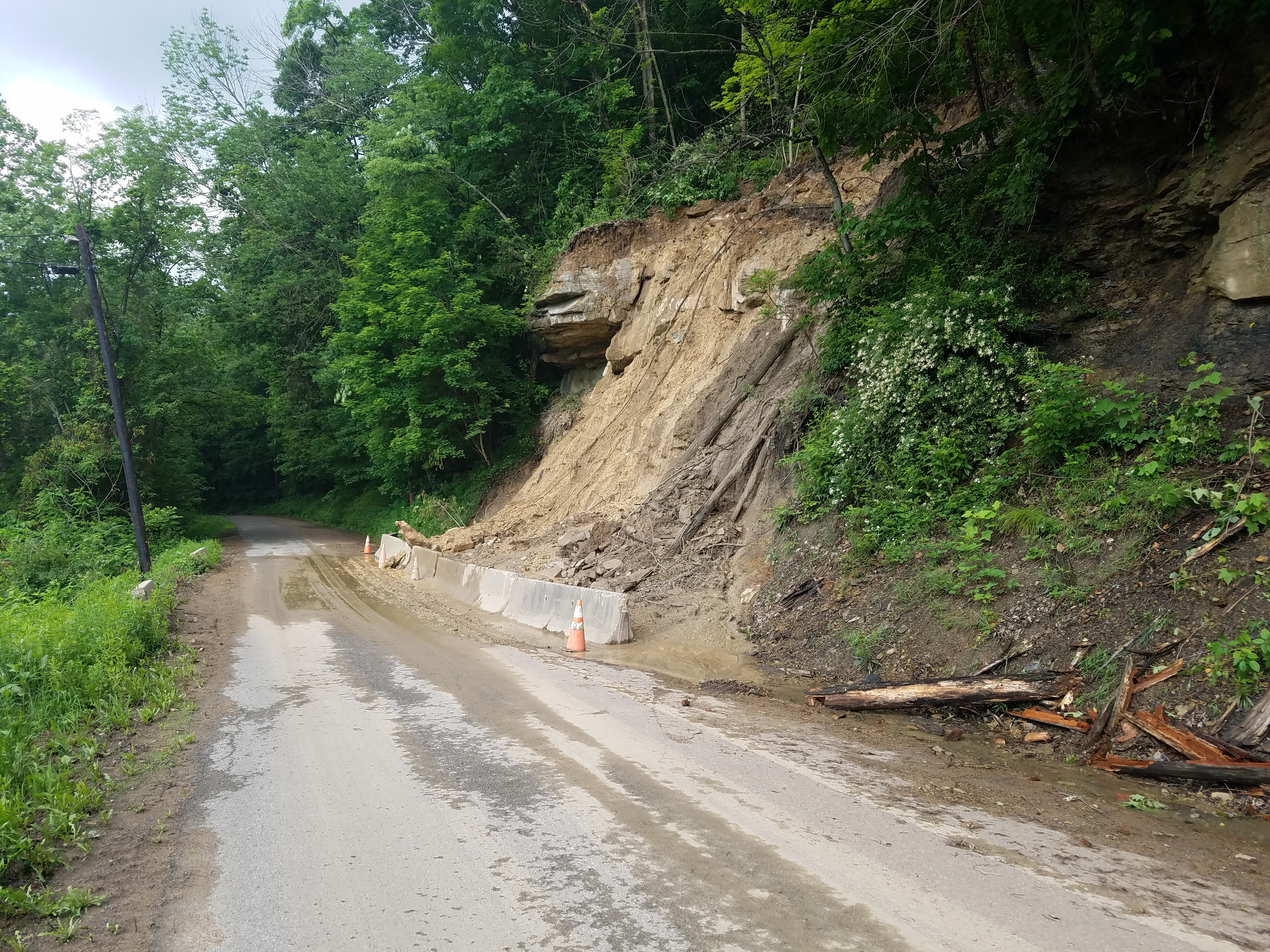
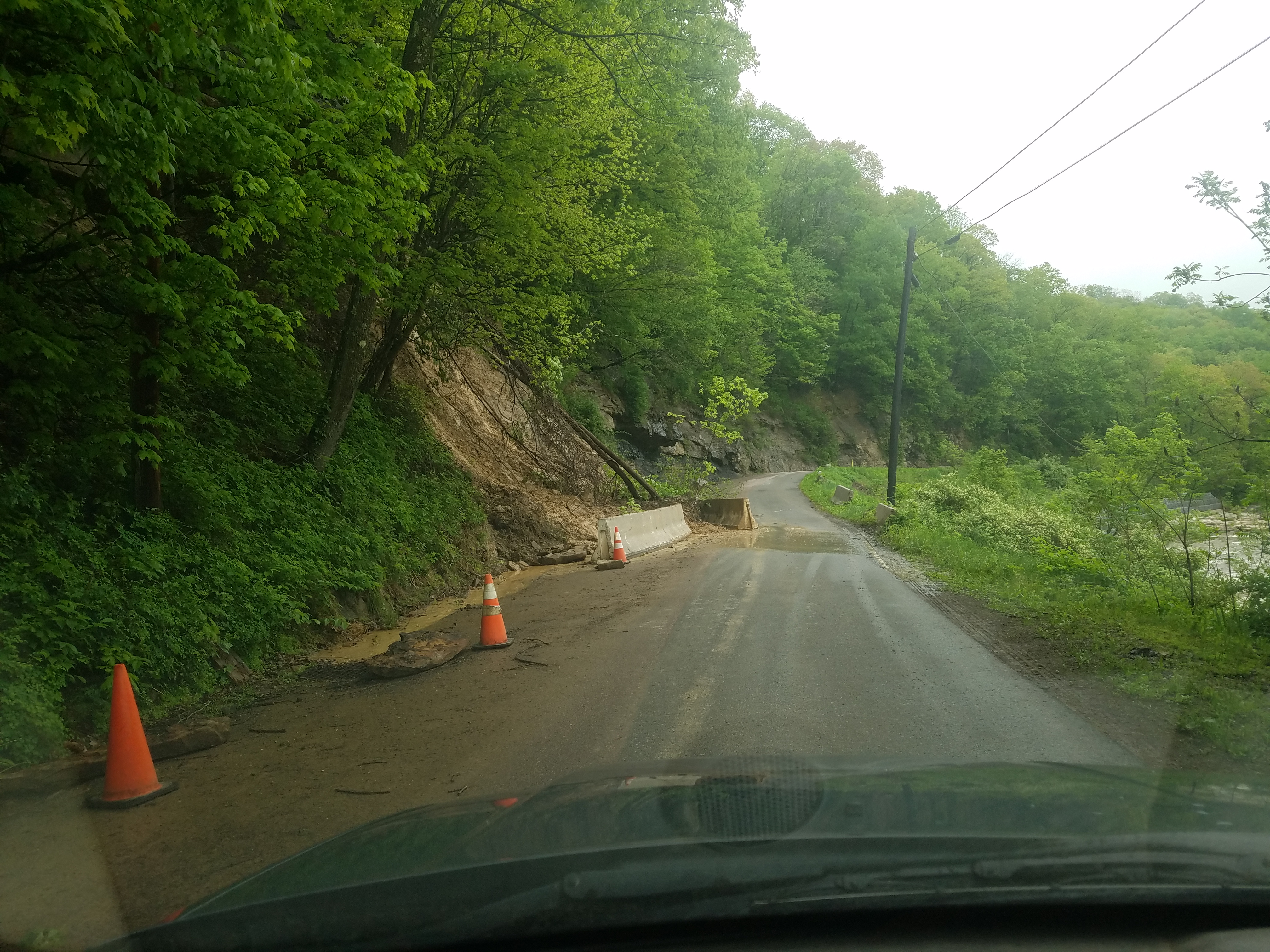
A recent landslide occurred near the tiny town of Shallmar in the southwestern part of Garrett County, immediately adjacent to the North Branch of the Potomac River. A landslide that closed the only access road into Shallmar was determined, by MDE personnel, to be a result of drainage from an abandoned deep mine. The Maryland Mining Program went to work taking water samples, did onsite engineering analysis and began preparations to stabilize the slide. In conjunction with Garret county road crews all debris was removed from the road allowing access back into town. With an unstable slope above the road and drainage from a nearby abandoned deep mine, the likelihood for another landslide is very probable.


Maryland does not have the estimated $750,000 needed to complete the work to make the access road safe again and is partnering with the Federal Office of Surface Mining to obtain the emergency funds and expertise. With funding secured, the process of plan development and then construction can begin. Every effort will be made to have the site secured before the freeze/ thaw of winter sets in and working conditions will become too dangerous to proceed.
Casselman River Watershed
Four years ago, MDE’s Abandoned Mine Land Division had an award-winning project cleaning up the acid mine drainage in the Aaron Run watershed in Garrett County which allowed populations of brook trout to flourish once again.
Now, the division, headquartered at the agency’s office in Frostburg, has another major success story -- covering a much larger area in the Casselman River watershed -- to hang its hat on.
The Casselman project marked the first time of the widespread usage of limestone sand -- a source for alkalinity to counterbalance acidity – and leach beds of crushed high-calcium limestone for water treatment in a large watershed. The 66-square-mile Casselman watershed is west of the Continental Divide in the drainage area of the Ohio River basin stretching north into Pennsylvania while Aaron Run is in the Chesapeake Bay watershed.
“The fish recovery has been remarkable due to the Abandoned Mines Land Division’s recently completed projects,” said MDE Abandoned Mine Division Chief Mike Garner. In addition to recovery of fish species, observers say that numbers of aquatic macroinvertebrates in the tributary streams have soared. The U.S. Environmental Protection Agency has published success stories on some of the treated streams.
Four of them in the Casselman watershed-- Alexander Run, Big Laurel Run, Spiker Run and Tarkiln Run -- have been delisted for low pH, because of the restoration activities implemented by the Abandoned Mine Lands group.
Alan Klotz of the Maryland Department of Natural Resources provided MDE with a brook trout population update in August. Among Klotz’s observations were that brook trout were collected for the first time in the North Branch of the Casselman River and that Alexander Run had been fishless because of acidity but 18 adults and 60 young were counted in 20 minutes of electrofishing. At Tarkiln Run, Klotz noted that one brook trout was collected in a 1997 survey and it was fishless in 2014. But 17 brook trout were collected in 10 minutes during a July survey.
Acid mine drainage from abandoned mine lands and acid rain over decades led to low levels of pH in the Casselman and its tributaries and a federal listing for low pH impairment in 1996. The acid also created a significant reduction in native brook trout numbers in the watershed.
A total of 18 limestone sand application sites and four limestone leach beds were constructed at targeted locations throughout the main branches and tributaries from 2012 through 2017. It didn’t take long for the pH water tests to meet Maryland water quality standards of 6.5 to 8.5 with dramatic improvements in brook trout health population and “phenomenal biological community improvements.”
“It’s a very low tech and much cheaper solution than other projects using dosers from the past,” said Environmental Program Manager Connie Loucks. “It’s important to make sure you have your sand application sites properly located.”