|
Click on photo to view larger image

|
When changes occur on a map faster than we can print them on paper, it’s time to enter the digital age. The Federal Emergency Management Agency (FEMA) recently began a mapping program to replace its 100-year floodplain paper maps with a digital map product. This is part of a nationwide, federally funded Map Modernization Program using state and local government participants in the mapping process. Ultimately, these new maps will be used by planners and regulators to direct development out of the 100-year floodplain, by insurance agents and homeowners to determine proper insurance coverage available through the National Flood Insurance Program (NFIP), and by lenders to determine NFIP flood insurance requirements for federally-backed loans.
In 2003, FEMA requested interested state and local governments to submit proposals to convert their floodplain maps. In response to this request, MDE submitted a business plan to FEMA. The plan was accepted and as of April 2004, a statewide Map Modernization process is underway at the Maryland Department of the Environment (MDE).
Proposed Project Brings 17 Counties into the Digital Age
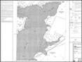
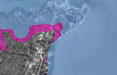
Through the Water Management Administration’s Wetlands and Waterways Program, MDE oversees Maryland’s NFIP Program. MDE also administers the state statute and regulations for waterway construction activities affecting the 100-year floodplain. A 100-year flood is an event that has a one-percent chance of occurring in any given year. It is the measurement used to assess regulatory and insurance decisions at all jurisdictional levels. MDE’s plan combines its regulatory requirements and available Geographic Information System (GIS) data layers with FEMA’s mapping program to create updated digital floodplain maps. MDE will generate engineering models to produce maps that show flood risks in three dimensions. MDE’s enhanced floodplain-mapping program will produce new digital maps for 17 Maryland counties and significantly improve state and federal floodplain programs.
Several local governments are directly involved in FEMA’s Map Modernization Program, including Baltimore, Prince George’s, Frederick, and Montgomery Counties and Baltimore City, compliment MDE’s efforts. In addition, Harford and St. Mary’s Counties which recently converted to digital floodplain maps. The remaining 17 counties are in MDE’s Program’s Business Plan adopted by FEMA.
MDE’s Enhanced Technology is a Winner
FEMA’s Map Modernization Program uses digital conversion of existing NFIP paper maps. In many cases, these maps are outdated. MDE’s map modernization process will enhance FEMA’s standard maps to provide better risk assessment. MDE will update digital map data to accurately reflect current flooding conditions using existing state programs and data layers. For example, using modeling techniques developed by the University of Maryland for the Maryland State Highway Administration and land use information available from each county, MDE can map existing and future development conditions. MDE has also collected field data for bridges and other road crossings and merged this data with recent topographic data to calculate new water surface profiles. This translates into new base flood elevations for virtually every nontidal stream in the original paper map process.
With Modernization Comes Limitations
No additional funding was available from FEMA to modernize or update the tidal 100-year floodplain. Consequently, digital maps being produced for areas that experience tidal flooding reflect original FEMA elevations plotted on new base maps with updated topographic information. FEMA’s Map Modernization Program does not utilize recent studies prepared by counties or municipalities due to funding and quality control concerns.
Opening the Floodgates of Advancement: Project Status
MDE has received the hydraulic data necessary to prepare new digital floodplain maps in Wicomico, Dorchester, Howard, and Somerset Counties. MDE has provided this data to FEMA for their review and approval. Final review, including community appeals, will take place over the next six to eight months. Maps for these counties will be completed by MDE, adopted by FEMA, and available on MDE’s GIS data server in 2007. In the meantime MDE is collecting field data and modeling waterways in Anne Arundel, Calvert, Cecil, and Talbot Counties. Finally, MDE has secured funding and is scheduled to begin modernizing maps for Allegany, Garrett, Washington, and Carroll Counties in 2007. Work on the remaining counties will begin in 2008 and 2009.
For additional information on MDE’s floodplain mapping effort, please contact Mr. David Guignet by telephone at 410-537-3775 or by email at Dave.Guignet@maryland.gov.
|
