Maryland Shellfish Advisory and Maps

​​

MDE Shellfish Harvesting Waters Conditional Closure Log
for
Friday, May 30, 2025
River SystemRestricted DatesReopening Date
Area 1 - Cuckold Creek5/30/25 - 5/31/256/1/25
Area 2 - Breton Bay, St. Clements Bay, St. Patrick's Creek5/30/25 - 5/31/256/1/25
Area 3 - Piney Point Crk, St George Crk, St. Mary's Riv, Smith Crk, Jutland Crk, Tarkill Cove5/30/25 - 5/31/256/1/25
Area 4 - Tanner Creek5/30/25 - 5/31/256/1/25
Area 5 - Mill Creek5/30/25 - 5/31/256/1/25
Area 6 - Patuxent River5/30/25 - 5/31/256/1/25
Area 7 - Herring Bay, Rhode River5/30/25 - 5/31/256/1/25
Area 8 - Miles River and Leeds Creek5/30/25 - 5/31/256/1/25
Area 9 - Chester River5/30/25 - 5/31/256/1/25
Area 10 - Eastern and Prospect Bays - Crab Alley Bay and a portion of Crab Alley Creek5/30/25 - 5/31/256/1/25
Area 11 - Island Creek, LaTrappe Creek, Bolingbrook Creek, San Domingo Creek, Haskins Creek, Harris Creek, Broad Creek, and Irish Creek5/30/25 - 5/31/256/1/25
Area 12 - Little Choptank River, Brooks Creek, Hudson Creek, Phillps and Beckwith Creeks, and Slaughter Creek5/30/25 - 5/31/256/1/25
Area 13 - Wicomico River (eastern shore)5/30/25 - 5/31/256/1/25
Area 14 - Big Annemessex River5/30/25 - 5/31/256/1/25
Area 15 - Pocomoke Sound: Ape Hole Creek5/30/25 - 5/31/256/1/25
Area 16 - Honga River: Long Cove5/30/25 - 5/31/256/1/25
Area 17 - Nanticoke River5/30/25 - 5/31/256/1/25

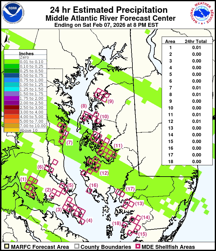
Conditional closures are based on an analysis of NOAA rainfall data as shown in the following regional graphic.
Graphic